
-
+91-4049953666, 040-42218456
Free Call -
info@igisindia.com
Email Us -
No. 12- 13- 382, Street No. 18, Tarnaka,
Hyderabad - 500017, Telangana, India

SSR-MP1-ME
The IGIS Microprocessor based Signal Enhancement Resistivity Meter Model SSR–MP1 is a high quality
microprocessor based data acquisition system incorporating several innovative features. The instrument
design incorporates several advanced techniques of digital circuitry to make it reliable geophysical tool that
provides high quality data useful for all types of mineral and groundwater exploration research etc.
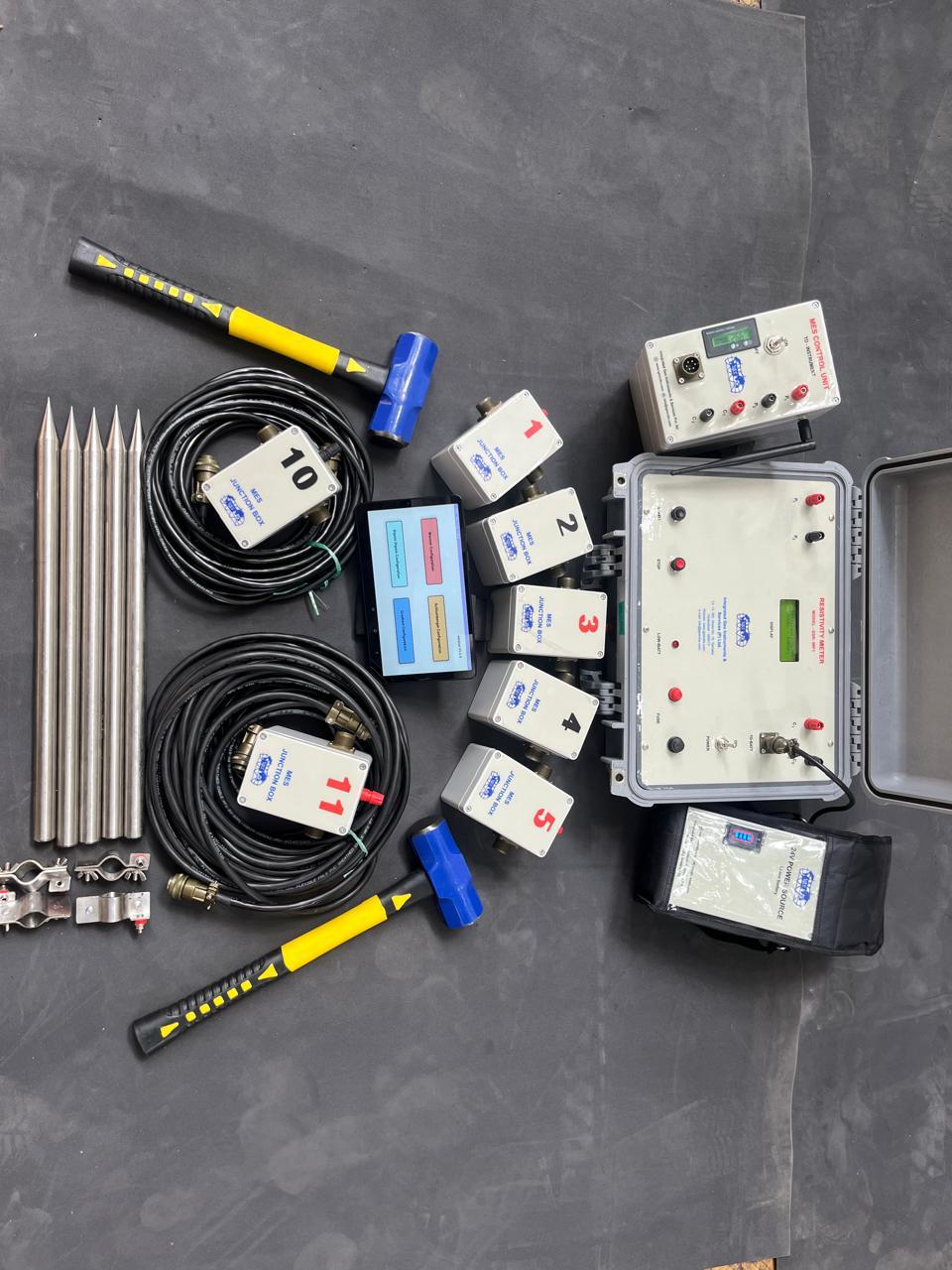
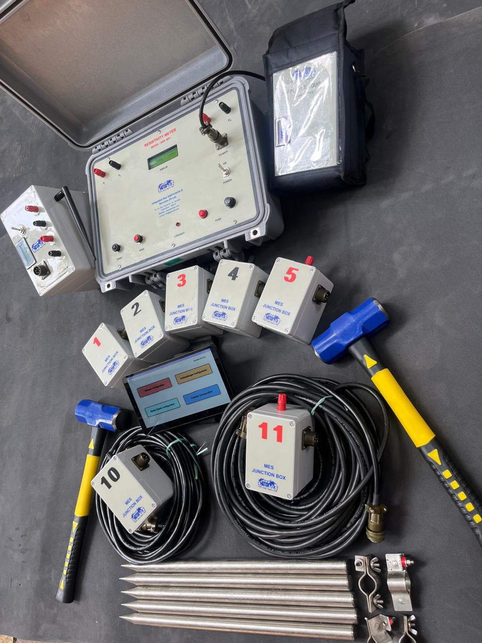
IGIS Multielectrode solution (MES)
The multi-electrode method is popularly used for identifying potentially favourable zones for obtaining
groundwater, such as areas with a maximum depth of weathered zones of fracturing and faulting, and high
porosity and permeability zones associated with lithological contacts.
The apparent resistivity pseudo sections measured with such a technique are processed by an inversion
software which gives interpreted resistivity and depth values for the anomalies detected along the profile.
The multi-electrode resistivity technique consists in using a multi-core cable with as many takeouts (24, 48,
60, 120) as electrodes plugged into the ground at a fixed spacing, every 10m for instance.
MES control unit supplied along with the unit acts as an interface to the instrument SSR-MP1-ME and the
relays located at each electrode ensures the switching of those electrodes according to a sequence of
readings predefined /configured /stored in the internal memory of the MES control unit. The various
combinations of transmitting (A,B) and receiving (M,N) pairs of electrodes construct the mixed sounding /
profiling section, with a maximum investigation depth which mainly depends on the total length of the cable.
The 2D resistivity images obtained with such a multi-electrode technique are used for studying the shallow
structure of the underground located a few tens of meters down to about one hundred metres depth; these
images supply an information which complements the one obtained with the more traditional Vertical
Electrical Sounding (VES) technique, which mainly aims at determining the depths of horizontal 1D structures
from the surface down to several hundred meters depths. Several examples are presented for various types of
applications: groundwater, mineral, geo-technical, environmental and so on.
The application is designed in such a way that once the electrodes are plugged onto the ground as per the
spacing, the user can opt for any of the methodologies like Wenner / schlumberger / Gradient / Dipole or user
defined one after the other or as per his choice
